HALIFAX — It is immediate and tangible and touches all of our senses.
We walk out the door and it jolts us and drags our wandering mind back to the present.
The weather.
But there’s nothing tangible or immediate about what makes it.
The closest we get to understanding our weather lies in the jet stream, jet stream, that squiggly blue line traversing Canada from west to east on the evening news’ weather forecast.
But it’s there – a current of air 10 kilometres up, barreling along at often upward of 100 kilometres an hour.
Then there’s the Gulf Stream, a 100-kilometre-wide river in the ocean that carries warm water from the Gulf of Mexico up the Atlantic Coast and past Nova Scotia before heading toward Europe.
They are massive forces powered by other massive forces that govern the weather outside our windows.
Few of us ever get to experience them as more than a mental exercise.
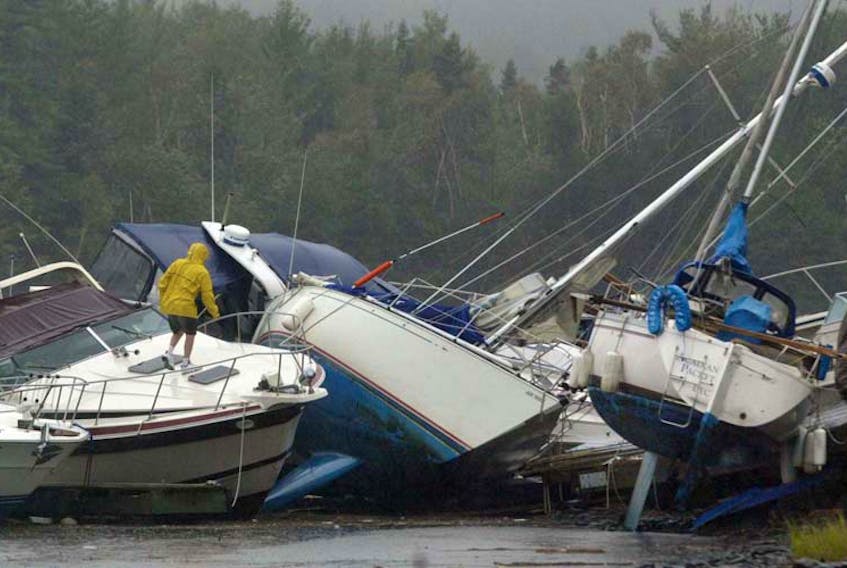
Except when that mental exercise pummels into your province like a freight train or a hurricane like Juan.
RELATED
- St. F.X. professor's research helps people cope with anxiety over storms
- PHOTOS: Hurricane Juan hits the Maritimes
- Fifteen years ago, hurricane Juan gave P.E.I. residents a wake-up call on improving emergency preparedness
- Hurricane Juan's path displaced outhouse, rabbit and trampoline for P.E.I. residents
And we might be in for more of them with stronger winds.
“With the rise of sea surface temperatures since the mid-70s the number of hurricanes to reach category 4 and 5 has doubled,” said Cindy Day, meteorologist for the SaltWire Network.
“From that, given what we’ve been seeing since the turn of the century, (some scientists) believe the frequency and number of category four and five storms will double again by the end of this century. We’ll see more coming up and staying strong.”
Now we’ll return to the world of mental exercises for background.
More hurricanes could hit eastern seaboard
A November 2016 article published in the academic journal Scientific Reports predicted that more hurricanes will snake their way up the eastern seaboard due to changes in air circulation near the equator where they form.
Sponsored by the European Union-funded Hurricane Project, the team from Durham University in the United Kingdom hypothesized that the trend results from the expansion of atmospheric circulation belts driven by increasing carbon dioxide emissions.
As they come up the eastern seaboard they will be travelling over the Gulf Stream’s warm water.
The Gulf Stream is slowing, according to two articles published in April by different research teams in the journal Nature.
As it slows, it tracks slightly farther north – hugging tighter to our coast and filling the Gulf of Maine with more of its warm Caribbean water.
“Hurricanes need that latent heat released into the centre of the storm to remain strong,” said Day.
“The warmer the water, the more evaporation of air and that evaporation feeds the bottom of the storm.”
Nova Scotia's worst storms
According to Environment Canada records, 32 hurricanes have made landfall in Nova Scotia since 1863.
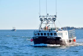
With its 155 km/h winds, hurricane Juan was one of the stronger storms.

Though it wreaked havoc on infrastructure and was blamed for eight deaths, it pales in comparison to the toll taken by storms of the past when warning came late and our men were at sea in wooden ships.
Eight fishing boats, including four schooners from Lunenburg alone, went down in the 1927 storm that took 192 lives.
In 1775, a hurricane tore up the coast killing an estimated 4,000 sailors – mostly men from Ireland and England fishing on the Grand Banks off Newfoundland.
Beyond hurricanes, climate change will have other effects.
“We can expect coastal threat from sea level rise, potentially more devastating hurricane landfalls, and inland threats from extreme floods and heatwaves,” said Michael Mann, professor of atmospheric science at Penn State University.
“The impacts of climate change are no longer subtle.”
The warm water of the Gulf Stream pooling off our coast causes high pressure systems to sit in place.
In turn the jet stream is pushed northward – so those smaller weather systems that are carried from west to east no longer pass over our heads.
During the month and a half this summer that we had barely any rain was what Day calls a ‘heat dome’ of warm air that pushed weather systems north of us.
While it made for nice beach weather, in the winter the warmer water will also mean more precipitation to feed snow storms.
“Scientists are not sure whether there will be more thunderstorms and snow storms but they will become more powerful because there’s more moisture available,” said Day.