SYDNEY, N.S. — The “Big Lift” will never be known as a mega-engineering project.
After all, workers on the latest Wash Brook flood mitigation project merely raised a short span railway bridge by the grand total of about three feet. Not the biggest lift ever recorded, but one that, according to John Phelan of the CBRM’s public works department, will address one of the many flood threats facing the municipality.
“Over the years it’s become a real problem in the winter because the bridge is just barely above the brook and the ice builds up and the water can back up further upstream in that low part of the city,” he said.
“Our guys were down there all the time pulling the ice away from the bridge.”
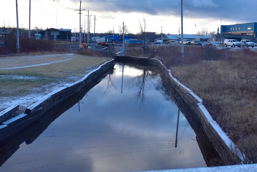
The “down there” that Phelan refers to is where the Wash Brook, a seemingly innocent and gentle stream, flows through a narrow channel located between the Centre 200 complex and the Sydney Shopping Centre.
But the meandering waterway that winds its way from Sydney’s south end, through low-lying residential areas and eventually into the harbour is susceptible to flooding. One need only recall the devastating Thanksgiving Day 2016 flood that was caused by 225 millimetres of rain over the relatively short period of time that led to extensive damage, including the eventual demolition of more than 25 houses and buildings.
Phelan said the “Big Lift” is just a small piece of the flood mitigation puzzle, but one that is expected to alleviate the build-up of ice at the short bridge that has been used for more than two decades as a shortcut for local pedestrians.
“The problems happen when the tide is high and the water pushes the ice back upstream where it got jammed up against the bridge which only had two feet of clearance at best,” said Phelan, adding that the short span crosses the waterway at one of its narrowest points.
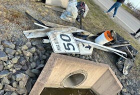
“It’s done now and I don’t think we’re going to have the problems we have in past winters when it threatened places like the Cedar’s Club with flooding. The people that used it as a shortcut will have to walk around. We put a permanent fence in there because public safety is our number one concern.”

So, how does this relatively minor flood mitigation project tie in with Sydney’s “road to nowhere” that has been sitting dormant since it was constructed in 2013 as part of the 10-year, $400-million remediation of the Sydney tar ponds and associated sites?
It’s all about the rails.
The Big Lift tracks are part of a spur line that deviates from the main Cape Breton rail line on the Wash Brook plain just south of Prince Street. That spur, owned by the Cape Breton and Central Nova Scotia Rail, continues through the site of the former Sydney steel plant and eventually crosses the Sydney Ports Access Road (SPAR) just east of the Lingan Road intersection.

For reasons never entirely explained although mention has been made of insurance issues and rights-of-way, the railroad’s parent company, the U.S.-based Genesee and Wyoming (G&W), has forbade the municipality from opening the road.
Just ask CBRM District 12 councillor Jim MacLeod. He’s been frustrated by the road’s “on hold” status for years.
“I never agreed with them holding it up,” said MacLeod.
“That rail line has been inactive for a long time – it’s been 25 years since the last engine and caboose rolled down those tracks so as far as I am concerned it has a dead line for a long time.”
On the day work began on the Big Lift in early December, MacLeod ironically stated that he hoped it would lead to the eventual opening of the almost forgotten “road to nowhere.” Within hours, the province’s Department of Transportation and Infrastructure Renewal responded to a Cape Breton Post inquiry on the matter with a statement that it had just received permission to rip up the tracks near the intersection of Lingan Road and the SPAR. No further explanation was provided.
Meanwhile, work is continuing at the junction in question although an opening date has yet to be set for the thoroughfare that will offer motorists an alternative route between Whitney Pier and the rest of Sydney.
RELATED: